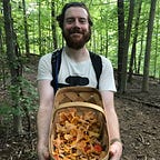
“Maryland Farm or Forage” Story Map and Feature Service
Using ArcGIS Pro and ArcGIS Online (AGOL), I created a feature service that users can download to develop unique locational datasets for small-scale agricultural projects or cataloging their foraging finds. Below is the Story map I made to describe the project. Start with the story map to familiarize yourself with the service. The second to last page provides links for creating an ArcGIS account, whether a trial, public account, or paid($100/year). As you make your way through the tutorial, embedded below and linked in the story map, access the feature service from the story map. Check it out, and I look forward to any feedback or commentary you may have!
Storymap URL: https://storymaps.arcgis.com/stories/65e999573bde47af9c0383bc21fff91c
This feature service and story map was the last project I completed for CCBC’s Advanced Geospatial Applications Certification. It’s not a complex dataset, which was intentional for users new to mapping software, but I think it’s an attractive web service to plot your data. I intend to create some models to extract raster data using the point data, such as generating weighted costs to obtain more insight into the area where data resides. This model creation requires more research on my end, specifically in mycology, and what sort of data would be beneficial to combine with the points, such as precipitation and slope data. I have a lot of work to do, and I look forward to creating it! In the future, I will also attempt to replicate this feature service in a more open-source medium, specifically QGIS, as I want this project to be more open.
Taking night classes over the last couple of years while juggling a career in something completely unrelated has been challenging but incredibly rewarding. This lateral career move has been humbling, to say the least, as the learning curve is steep, but I’ve had great support along the way from my peers and instructors. There is an indefinable amount to learn from the brilliant creators of the GIS/Geography/Cartographic world. In a future master’s program, I hope to make a positive contribution and learn from the best.
Let me know if you have any questions! email: kendall4@umbc.edu

Disclaimer: I, Adam Kendall, the author of this story map, feature service, and style file disclaims any liability in connection with the use of this information system and it’s data. In particular, eating any wild mushroom or plant is inherently risky. Wild plants and mushrooms are easily mistaken, and individuals vary in their physiological reactions to wild plants and mushrooms that are touched or consumed. This is not a foraging identification application, this is a personal cataloging geographic information system.
This feature service, story map, and style file are meant for users to manage or catalog their farming and foraging “spots” (locations) on a map, respectively. It is the user’s individual responsibility to correctly identify wild edibles, not the author of this map, feature service, and corresponding style file. It is also the user’s individual responsibility to know the rules and regulations regarding the locations you plan to forage from. The author of this feature service, story map, and style file does not condone foraging on land where foraging isn’t allowed.